Digital Photogrammetry
As stated earlier, digital photogrammetry is a branch of photogrammetry which has emerged as a result of advances in computer technology and sophisticated instrumentation and software capabilities. Digital photogrammetry refers to the application of image, processing techniques for map and geoinformation production using aerial photographs and satellite images. A digital photogrammetric system is an all- digital photogrammetric system which employs digital image processing techniques for solving photogrammetric problems such as map compilation, DTM collection, production of digital orthophotos, etc. It is also called pixel photogrammetry because the images are recorded in pixels. photogrammetrists are optimistic about the future of digital photogrammetry.
Digital Photogrammetric System (DPS)
The main element of a digital photogrammetric system is the digital photogrammetric workstation (DPW). This system has achieved a great success in digital mapping and in the field of orthophoto production and in the closely-associated area of digital elevation data acquisition. A digital photogrammetric system includes a camera, a tape unit (disc unit), a computer and an array processor, and image display unit, a stereo video monitor with corresponding observation system control panel and image memory, a drawing table, raster plotter magnetic disc tape and some other peripheral devices.
The basic characteristics of Digital Photogrammetric System are as follows:
- It combine computer hardware and software that allow photogrammetric operations to be carried out on digital image data.
- The imaging sensor can take the form of :
- A digital camera equipped with an areal array of charged coupled detectors (CCDs)
- A pushbroom scanner with a linear arrary of CCDs. Each of these detectors give a direct output of the image data in a digital form through analogue-to-digital conversion (ADC) of the radiance value, which is measured electrically for each individual element of the sensor.
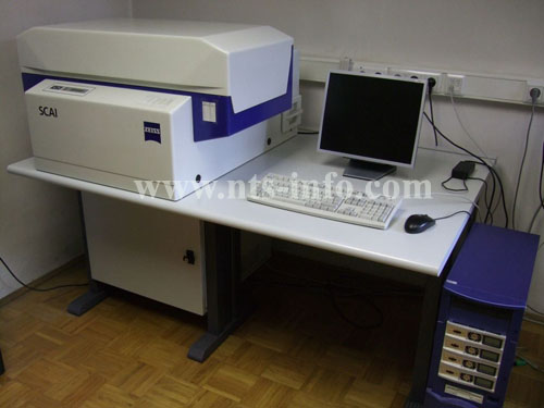
- 3. For topographic mapping operations, however, digital image data are most often derived from the frame images on photographic films produced by an aerial camera. these film images need to be converted to digital form by using high- precision scanners equipped with linear or areal CCD arrarys. In this case, the scanner forms a vital and an integral part of the DPS.
- Presence of a digital photogrammetric workstation on which theb required analytical ( i.e mathematically- based) photogrammetric operations are carried out to produce data for input to digital mapping system or CAD system, or GLS/LIS systems.
- The photogrammetric operations include: automatic or semi-automatic operations such as generation of digital elevation model data and ortho-image data.
- The final output may take the form of vector line map, digital terrain model data or digital ortho-images.

No comments:
Write comments