MODERN SYSTEMS IN
SURVEYING AND MAPPING
Significant
developments in the last three decades resulting in a variety of sophisticated instruments
have revolutionized the techniques of conventional surveying and mapping. Such
innovations are still continuing, leaving behind the conventional methods and
making them out dated. As the technological development in instruments and
processing techniques is so phenomenal that is difficult to discuss these
comprehensively, therefore only brief description of some of the modern
instruments and terminology associated with measurement of quantities such as
length, area, volume, and coordinates of the points, has been presented in this
chapter.
1. ELECTRONIC DISTANCE MEASUREMENT INSTRUMENT (EDM)

Recently
scientific advances have led to the development of electro-optical and
electromagnetic instruments which are of great value to the surveyor for
accurate measurements of distances. The electronic distance measuring (EDM)
equipment which can be used for traverse, triangulation, and trilateration as
well as for construction layout, is rapidly supplanting taping for modern
surveying operations except for short distances and certain types of
construction layout.
Electronic distance
measurement instruments utilize either infrared (light waves) or microwaves
(radio waves). The microwave system requires a transmitter/receiver at both
ends of the line to be measured, whereas the infrared systems require a
transmitter at one end and a reflecting prism or mirror at the other end.
Microwave systems have a usual upper measuring range limit of 50km. Although
the microwave systems can be used in poorer weather conditions (fog, rain, etc)
than infrared systems, the uncertainties caused by varying humidity conditions
over the length of the measured line, result in lower accuracy expectations.
Infrared systems come in
long range (10-20 km), medium range (3-10km), and short range (0.5-3km).
EDM can be mounted on
the standards or on the telescope of most theodolites; additionally they can be
directly mounted on the tribrach. EDMs measures slope distance between two
points if at different elevations. The slope distance is reduced to its horizontal
and vertical equivalents using the slope angle between the two points. EDMs
when used with a theodolite, they can provide both horizontal and vertical
position of one point relative to another.
EDMs have built in or
add-on calculator/microprocessors which provides horizontal and vertical
distances.
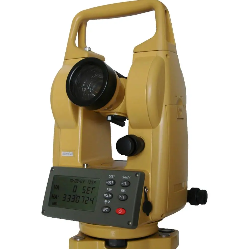
ELECTRONIC THEODOLITE

The most modern theodolite contain circular encoders which sense the
rotations of the spindles and the telescope, convert these rotations into
horizontal and vertical angles electronically, and display the values of the
angles on liquid crystal displays (LCD) or light emitting displays (LED). These readouts can be recorded in a
conventional field book or can be stored in a data collector for future
printout or computations. The circles can be set to zero readings by simple
press of button on the instrument. The horizontal circle readings of some of
the electronic theodolites can be preset to any desired angle before a back
sight is taken.
ELCTRONIC TACHEOMETER OR TOTAL STATION

Electronic tacheometer or total stations are instruments which combine
electronic theodolite and EDM instrument. They are equipped with a
microprocessor for reduction of observed data. Electronic tacheometer can
display horizontal angle, vertical angle, slope distance, horizontal distance,
difference in elevation, and coordinates. The data can be stored in some form
of storage device for further computations using an electronic computer.
LASER THEODOLITE

Laser theodolites have all the functions of electronic theodolite with
facility of more accurately bisecting the target. By means of cross hairs the
laser adaptor enables the observer to centre the laser beam very accurately on
the target. The cross hairs can also be rotated as desired.
Laser theodolite has a
wide range of applications including tunneling and mining, piling and fencing,
base-line surveys, marking and locating in space, shipbuilding and night
surveying etc.
AUTOMATIC TOTAL STATION

The total station described previously is a manual one in the sense that
it requires persons, i.e., the surveyor and a rod man holding the reflecting
prism or mirror. A surveyor always requires some communication system to
communicate with the rod man. Another disadvantage of these total station is
that sighting the prism is not only time taking job but also less accurate. The
automatic total stations overcome these problems. Automatic total stations have
motorized EDM and theodolite. It can align itself in any specific direction
very accurately (up to 0.5’’). by combing automatic target recognition (ATR)
with motorized system, survey is reduced to a single men’s job. The instrument
once aligned to prism or reflector, automatically tracks the movement of rod
man and is controlled by rod man. It eliminates the need of communication
system as the operator of the instrument is rod man himself.
Automatic total stations
are particularly very useful in areas of less vegetation and setting out jobs.
LASER ALIGNMENT INSTRUMENT AND
ELECTRONIC LEVEL

Laser (light amplification by stimulated emission of radiation) alignment
instrument produce a laser beam which is a visible straight line, used for
alignment and setting out works in roads and railways. They are also used in
the construction of large buildings and alignment of river dams. Laser beam can
be used as plumb line. It can generate a reference plane for measurements of
inclination and settlements, area leveling or profiles. Laser beam can also be
placing pipe lines and monitoring machines in direction and elevation.
Laser attachments are
also available which can be mounted onto the telescope of theodolite
transforming them to laser instruments.
Laser beam instruments
can be used in darkened areas indoors without a beam detector.
DIGITAL LEVEL


The digital levels use bar-code shafts. After targeting the staff, the
reading is taken automatically and displayed. The measurements can be recorded
in the field and down loaded into a computer for processing using the software
provided with the instrument. Digital levels permit measurements to be made
even when light conditions are inadequate. The staff section to be illuminated
can be selected by moving the illuminator up or down.
No comments:
Write comments